 Ref., OGS Doc ARV51.pdf - (arv51 mineral occurances in parry sound district with map 51a by J satterly 1946)
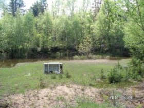
The occurrence on lot 22 (claim P.S. 992), concession VIII, Lount township, is known locally as the Spring Lake deposit, being 3 1/2 chains west of the road to Fowke (Spring) lake. A pit, 8 by 10 feet and 10 feet deep, has a stripping around the top 3 to 4 feet across, widening to 6 feet on the north side, where an old diamond-drill hole, nearly vertical, has been plugged.
It is reported by J. W. Edwards to be 50 feet deep. This pit was cleaned out by United States interests early in June, 1941, but was partially filled with water at the time of the writer's visit on June 22, 1941.
The country rock is a light-coloured, medium-grained hornblende gneiss striking approximately east and west and dipping 300 N.
Under the microscope in thin section this rock is seen to be composed of an equigranular aggregate of hornblende, scapolite, and plagioclase and abundant accessory apatite, titanite, epidote, and green spinel. It is a hornblende-scapolite gneiss.
Seams of coarse calcite (crystalline limestone ?), 6 to 18 inches thick, dip parallel to the foliation.
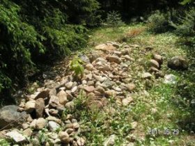
On the north side of the pit a magnetite band containing garnet and hornblende has a width of 2 feet. Irregular stringers and disseminated magnetite occur across a width of 4 feet at the south side of the pit, and a band of solid magnetite 3 to 12 inches in width, occurs 2 feet south of the mouth of the pit. A small trench 18 inches wide and 18 inches deep to bed rock extends 13 feet south from the pit mouth and exposes hornblende gneiss but no magnetite.
Crystalline limestone outcrops just southwest of the road junction.
Ref., OGS Doc ARV64.pdf - (Sixty-Fourth Annual Report of The Ontario Department of Mines, 1955 {Parts 6}, Pg 453, 457
Development - surface Work, 2 Pits, 2 Diamond-Drill holes.
Geology - Amphibolite (Scapolitized Metagabbro) With Lenses of Crystalline Limestone.
In June, 1941, the author was shown an old iron showing on lot 22, concession VIII, by J. W. Edwards. Surface work and the cleaning out of this old pit was carried out at that time, but by 1953 the workings had become largely overgrown. The description that follows is based partly on the information gathered in 1941. The main or west pit is about 250 feet west of the road to Fowke (Spring) Lake. This pit, 8 by 10 by 10 feet deep, has a stripping around the top, 3-4 feet across, widening to 6 feet on the north side, where an old diamond-drill hole,
nearly vertical, has been plugged.
 An early report states that two holes of 51 and 30 feet were put down on G. W. Fowke's property, "lot 32, concession VIII, " in June, 1902. These holes intersected hornblende gneiss and schist, and in each a narrow band of magnetite was cut. There is a typographical error in the old report the lot number being given as 32 instead of 22.
At this pit the country rock is a light-coloured medium-grained scapolitehornblende gneiss, striking approximately east-west and dipping 300N.
Under the microscope, in thin section this rock is seen to be composed of an equigranular aggregate of hornblende, scapolite, plagioclase, and abundant accessory apatite, titanite, epidote, and green spinel.
Bands or lenses of coarse calcite (crystalline limestone (?) ), 6-18 inches thick and dipping parallel to the foliation, are exposed in the pit. On the north side of the pit there is a magnetite band containing garnet and hornblende 2 feet wide.
Irregular stringers and disseminated magnetite occur across a width of 4 feet at the south side of the pit, and a band of solid magnetite 3-12 inches wide occurs 2 feet south of the mouth of the pit. A small trench, 18 inches wide and 18 inches deep to bedrock, extends 13 feet south from the pit mouth and exposes hornblende gneiss but no magnetite.
The east pit, 100 feet east of the above, is a shallow pit 7 by 17 by 1-3 feet deep. It exposes a 2-foot seam of massive, coarse magnetite overlain and underlain by a light-coloured, medium-grained rock that thin-section study shows to be a scapolite-diopside-plagioclase granulite, probably a scapolitized gabbro. At the east end of the pit a garnet-hornblende rock is exposed.
The dip of the magnetite seam may be gently to the north.
Exposures around the showing are few. Crystalline limestone and some garnet skarn are exposed to the north and south. To the northwest there are exposures of a coarse, dark-green and light-grey metagabbro, and it is assumed there is a small body of gabbro intrusive into the crystalline limestone with minor bands or lenses of massive magnetite developed either near the contact or replacing inclusions of crystalline limestone in the intrusive.
YOU MIGHT ALSO LIKE
Share this Post
latest post
-
 Turnip Rock Lake Huron June 30, 2023
 -
 Lake Erie Captains January 30, 2023
 -
 Lake Superior Minnesota December 31, 2022
 -
 Lake Ontario Sturgeon December 1, 2022
 -
 National Park on Lake Erie November 1, 2022
 -
 Lake Erie frozen Foods October 28, 2022
 -
 Lake Erie Dental Erie PA October 27, 2022
 -
 Eagle Lake Ontario fishing Reports October 26, 2022
 -
 Lake Ontario beaches October 21, 2022