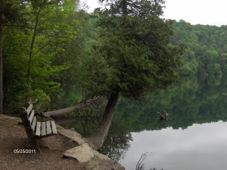
 Green Lakes State Park's outstanding features are its two glacial lakes surrounded by upland forest. Both Round and Green Lakes are meromictic lakes, which means that there is no fall and spring mixing of surface and bottom waters. Such lakes have a high potential for evidence of ancient plant and animal life. You will also find an old growth forest with trees over 300 years old located in the park.
Another special feature of the park is an 18 hole golf course, where visitors can snowshoe in winter, and there are many miles of hiking trails that cross-country skiers can use. This is a very popular state park in central New York as well as a very popular camping destination. The Old Erie Canal Trail is located just outside of the NY 290 entrance to the park. A bridge over the canal connects the state park with this popular recreational trail.
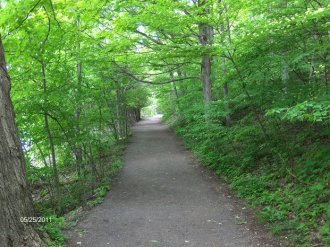
The most popular hike in the park is walking around Green Lake or adding a trip around Round Lake as well. The distance around Green Lake is 2.3 miles and Round Lake is 0.8 miles. Total around both lakes is 3.1 miles. There are nearly twenty miles of trails you can explore in the park. The hidden gem of the park is the surprising views from the Vista Trail that stretches all the way to the Tug Hill Plateau as well as Oneida Lake and Lake Ontario. There is a nice northeasterly view from the Rolling Hills Trail. The Overlook Trail features a pleasant view to the west toward the Erie Village area.
 You can create your own loop hike utilizing the trails on the west side of the park. There is a new parking area on the campground road on the way to the Rolling Hills area of the campground. This allows easier access to the trails in the western side of the state park. The GPS coordinates of the parking area are N43 03.081 W75 58.490 for those who have a GPS devise. There is an unmarked small parking area off NY 290 near the Erie Canal in the small hamlet of Manlius Center. The parking area is the trailhead for the Deer Run Trail. This remote trailhead gives hikers FREE access to the western side of Green Lakes State Park. The GPS coordinates for this trailhead are N43 03.240 W75 59.845 for those who have a GPS devise.
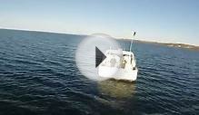
Below look for a few pictures, a video from a hike around both Green & Round Lakes and a trail map from Green Lakes State Park.
Directions
- Utica - Albany: Thruway (I-90) west to Exit 34A (I-481 south); to Exit 5E (Kirkville Rd. east) follow Kirkville Rd. right on Fremont Rd.; left on NY 290. Follow signs to Park.
- Buffalo - Rochester: Thruway (I-90) East to exit 34A (I-481 South); to Exit 5E (Kirkville Rd. east) follow Kirkville Rd. right on Fremont Rd.; left on NY 290. Follow signs to Park.
YOU MIGHT ALSO LIKE


Share this Post
latest post
-
 Turnip Rock Lake Huron June 30, 2023
 -
 Lake Erie Captains January 30, 2023
 -
 Lake Superior Minnesota December 31, 2022
 -
 Lake Ontario Sturgeon December 1, 2022
 -
 National Park on Lake Erie November 1, 2022
 -
 Lake Erie frozen Foods October 28, 2022
 -
 Lake Erie Dental Erie PA October 27, 2022
 -
 Eagle Lake Ontario fishing Reports October 26, 2022
 -
 Lake Ontario beaches October 21, 2022