 The town of Concrete, Washington is well-named. Well, it was. Because of a fortuitous limestone deposit, this small community in the Skagit Valley became a regional center of cement production. Beginning in 1905, portland cement was manufactured in the town from limestone. Cement from the town was used, among many other things, for hydropower dam construction. The nearest dam, Lower Baker is just north of town across a gorge in the Baker River. This dam, completed in 1927, is operated by Puget Sound Energy. A trio of dams operated by Seattle City Light is further up the Skagit River- Gorge (1924), Diablo (1936), and Ross (1952) Dams. (Ross Dam is in the news these days, due to a rock slide that blocks road access to the dam).
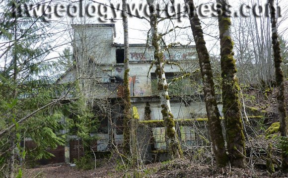
Concrete was formed from the merger of two towns: the charmingly – named Cement City, on the east side of Baker River, had the first cement plant, operated by Washington Portland Cement Co. The Superior Portland Cement Company built a rival plant across the river in the older community of Baker. The towns merged to form Concrete in 1909.
This field trip will visit the abandoned limestone mine near Concrete, which was last operated in 1962. A related field trip to a nearby limestone cave will be posted later.
Getting there: Concrete lies along Washington Route 20, 22.5 miles up the Skagit valley east of Sedro Woolley. There are two sets of cement silos in town, you can’t miss ’em!
- Folks traveling from the west: from Highway 20, turn north (left) on Superior Street by the
 unmistakable set of silos. Turn right at the stop sign onto Main Street, and go through town. At the east edge of downtown is a T-intersection by the map mural. Turn left, and cross the bridge over Baker River. At the far end, turn sharp left on the Baker River Road.
 - From the east: reach the east edge of town on Highway 20 and turn north (right) on Everett Avenue just before the eastern set of cement silos. Turn left in one block on E. Main Street, continue beyond the Puget Sound Energy offices and veer right on Baker River Road. Now we are all in the same place, the junction of Baker Dam road and East main. Set odometers to zero if you wish, but not really necessary for this trip.
- Everyone: Drive up paved, but curvy, Baker River Road. Stop at the overlook (0.2 miles) to look at the Lower Baker Dam. Raised to 293 feet (89 m) in 1927, it was the tallest hydro dam in the world. Stay left at the junction with Lake Shannon Road (0.6 mi). There is a Y at 1 mi. – the left goes to a view of the backside of Lower Baker Dam, and is recommended. Take the right, and you will quickly come to a blue gate. Continue on if the gate is open, if not, park and walk a couple of hundred yards into the abandoned limestone quarry, which is pretty hard to miss and 1.3 miles from where you turned off East Main.
 Geology of the limestone quarry
The old quarry is in limestone of the Permian, Carboniferous, and Devonian Chilliwack Group. The Chilliwack is a mishmash of marine rocks, including these limestones, as well as clastic sedimentary and volcanic rocks. The clastic sedimentary rocks are mostly volcaniclastic. All these rocks were accreted to the margin of North America in the Cretaceous. For more information, see Tabor and others (2003). The geologic map is available online, as is the accompanying text description. Limestone is a minor component of the Chilliwack Group- some has been metamorphosed to marble. The outcrop above the dam is one of the largest in the region; other fairly large limestone outcrops are found along the Dock Butte trail near the summit (which is reached by the Blue Lake Trail, above Sulphur and Rocky Creeks). In Whatcom County, limestone is mined north of Kendall on Red Mountain. This rock is commonly used as retaining walls in the area. An abandoned limestone mine is on Black Mountain, also in Whatcom County- you have to bushwhack to get there now.
Let’s take a look at the quarry above Lower Baker Dam. It is a big semicircular bite taken out of the hillside, and measures about 900 feet E-W and 700 N-S. I estimate the walls to be about 200 feet high; I used my buddy Bob Mooers as scale for my initial estimate, and then verified the height on the topographic map. There are plenty of big blocks of limestone lying around in the talus at the base of the high quarry walls. Bedding structure is nicely revealed, especially on the eastern wall. Beds dip 50 degrees to the north, as mapped by Tabor and others (2003). I looked for fossils- crinoids are reported from this quarry. I only found a small bits and pieces. Perhaps you will have better luck. If you find something nice, send a photo via comment! Tabor and others (2003) adopt earlier work to assign a Mississippian (322-347 Ma = early Carboniferous) age to the limestones, based on these crinoid fossils.
The steep, back wall of the quarry has some curious – looking structures. The slabby rock has numerous steep fractures running up and down the cliff that angle
Looking south toward the back wall of the limestone quarry. Plenty of bullet-riddled junk lying around.obliquely back into the rock, to the east. Looking very carefully at these fractures I saw fine grained, apparently cataclastic (meaning ‘broken up’) layers running along the trend of the fracture. I had to look in a number of places to get a good viewing angle to see that this feature was typical of many of these steep fractures. Further examination convinced me that this whole smoothish rock face is part of a shear (fault) structure, and the fractures are incremental slip surfaces. Subtle slickensides show that movement did occur along these fractures, although the rock tends to weather pretty easily and destroy the slicks. I had to look at a lot of fractures to be convinced this was what I was seeing. Please feel free to discuss via comments.
YOU MIGHT ALSO LIKE


Share this Post
latest post
-
 Turnip Rock Lake Huron June 30, 2023
 -
 Lake Erie Captains January 30, 2023
 -
 Lake Superior Minnesota December 31, 2022
 -
 Lake Ontario Sturgeon December 1, 2022
 -
 National Park on Lake Erie November 1, 2022
 -
 Lake Erie frozen Foods October 28, 2022
 -
 Lake Erie Dental Erie PA October 27, 2022
 -
 Eagle Lake Ontario fishing Reports October 26, 2022
 -
 Lake Ontario beaches October 21, 2022